The land where Taylorsville MetroPark now sits has a robust and storied history. It was once the site of the bustling town of Tadmor, one of the most important centers of transportation in early Ohio history.
As early as 1809, keelboats were poled up river from Dayton to take on freight from Tadmor. In 1822, the construction of a canal to connect Lake Erie to the Ohio River was commissioned. By 1837, the Miami/Erie Canal stretched, through Tadmor, connecting Cincinnati to Piqua and was finally connected to Lake Erie by 1845. Just two years later the first federally funded road (The National Road) was constructed through Tadmor. In 1851, the Dayton & Michigan Railroad established freight and passenger service to Tadmor. This faster and more dependable mode of transportation eventually led to the demise of the Miami-Erie Canal. Nevertheless, in 1852, trains, canal boats, keelboats, and wagon and coaches were heading in all directions from Tadmor. With all four means of transportation of the day within yards of each other, Tadmor was truly the Crossroads of America.
The great flood of 1913 put an end to Tadmor. As the Great Miami River swelled out of its banks, it drowned the stretch of train tracks surrounding the town and destroyed the aqueducts of the Miami/Erie Canal. When the water retreated, the train tracks were moved to higher ground and the canal, already in decline, was abandoned. The Miami Conservancy District took over the land and built the Taylorsville Dam in 1922. Old National Road was moved south to cross the top of the new dam. A structure or two remained in Tadmor until about 1960, when the last tenants moved out of the original grain dealer’s house and it was demolished.
Today, the Buckeye Trail follows the path of the original Dayton & Michigan Railroad through the park, and takes walkers and bikers through the ruins of Tadmor for a glimpse of important regional history.
Tadmor may be a place of the past, but Taylorsville Dam will always be home to several permanent residents. At the top of a hill near the south west section of the dam is a very strange site to find in a Metro Park
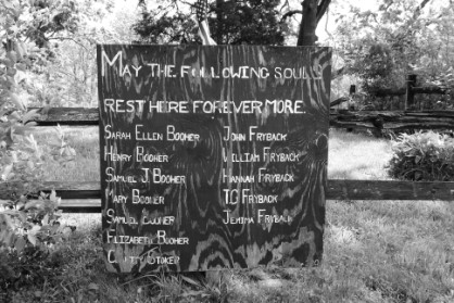 Most folks who use the nearby hiking trails never see the cemetery or are even aware of it. | This is "Booher" Cemetery. We call it "Booher" Cemetery due to the many folks who share the same name. 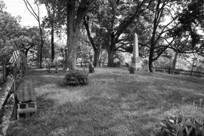 |
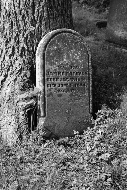 | 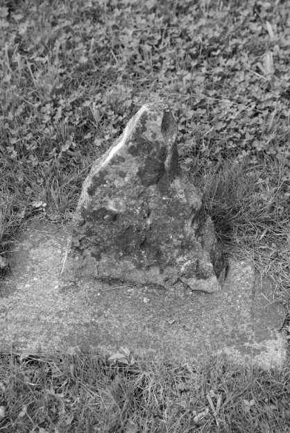 |
Some of the monuments at Booher Cemetery are still standing and in good shape. However, you will also find many are weathered and aged with time.
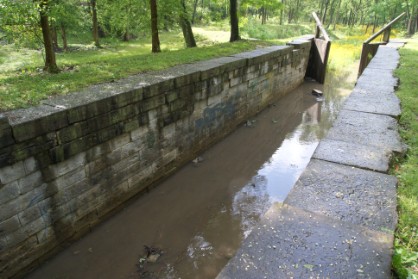
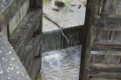
 The Huber Heights makes home for another former canal site. Canal Lock Park lies just south of the Taylorsville Dam. This lock was a direct connection to Tadmor, which was located only a few miles North. 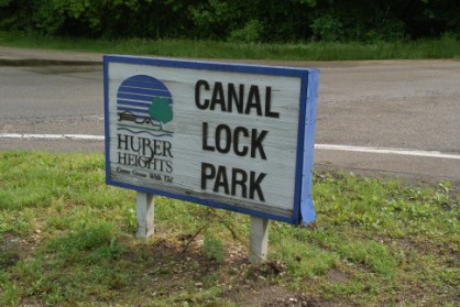 |  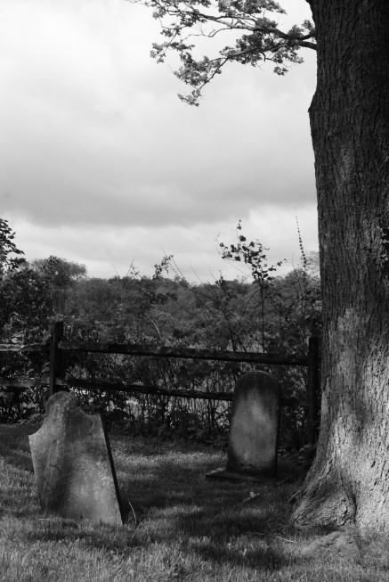 |
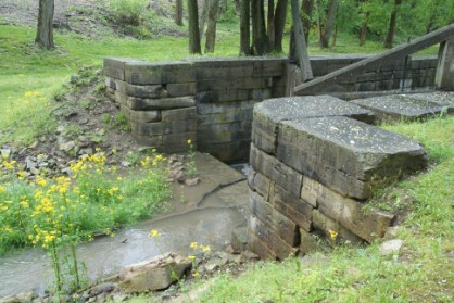 There is a trail near the lock. Passers by have said to hear a horse galloping north along the creek. | Some say that late in the evening you can hear the lock opening and closing as if it were still in operation. 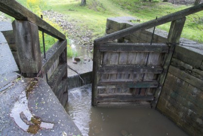 |
 |  |